People have speculated over the dates Atlantis sank for years. If you favor the Mediterranean version of Atlantis, you have one date. If you favor something something in the Atlantic near Bimini, you typically favor an older date. I tend to lean towards the later.
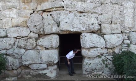
Many people believe that the sinking of Atlantis coincided with the subsequent rise of Egyptian culture. Based on the research by Robert Schoch into weathering around the Sphinx, the pyramids should be around 10,000 years old. The following video makes an interesting case. I haven’t figured out if the location makes perfect sense or it makes no sense at all. This is based on an inscription inside one of the air shafts. It’s 10 inches wide and if it weren’t for a robotic camera, no one would ever see this. It has the ring of a carpenters mark, but it also seems to say, this is when I finished. The two seem somewhat contradictory, since the first is almost always hidden (which this is), and the later is usually displayed for people to see. Assuming it is what it appears to be, we would have to assume that the builder was aware of star procession to the point that leaving this mark would have meaning in a few thousand years.


I think Atlantis was not only the name of a single Island / Continent, it was a complete Civilization that expanded to both sides of the Atlantic; and it had many outposts / settlements.
From my perspective and what I have read, it seem’s to have covered, not only the land masses in the Atlantic, but also included a large portion of Nothern America, over to the Eastern Mediterranean; ( perhaps even further, and over to Eastern Asia.) and as far south as the Southern portion of South America.
This theory may also explain the difference in dates, and accounts, of it’s “sinking”; as one portion of the civilization could have collapsed at a completely different time from the other, yet the recorded accounts could both be accurate, as several land masses, technically, could have been considered “Atlantis / Atlantean”.
For sure the pyramids are up to 12000 yers old , as in the video. But who did the video and is the star map confirmed.
The date of the pyramids at 10,000 years could be correct or close to it.
I have also spent some time looking for a possible Atlantis and like others i think i have found it.
I have some very good possibilities using science for where Atlantis was and why it sank that i am not willing to share atm.
I am tossing up weather or not to put it in a book as well as the real reason for the pyramids at giza.
It could be real i dont know i am only 11
But its rite beside morroco it looklike like one island and tow in the left or right
I was 11 when I started looking for it as well. That was a long time ago. You have a lot more tools available to you if you want to pursue the search. At any given time in earth’s history, 80% of the world population lived within 500 feet of sea level. Since sea level is several hundred feet higher in most parts of the world there’s probably more than a few sunken cities. In the Mediterranean alone, there are over 200 documented sunken cities. Scientists typically haven’t looked elsewhere because there is not supposed to be things in most of the areas some of us are looking.
I’m doing a project on Atlantis. That’s why I came here but since this is a comment page 😛
Just because the history books don’t show a civilization in North and South America around 10,000 BC, doesn’t mean there isn’t evidence. There are lots of sites in Bolivia that are extremely old. While not publicized there are sites in North America that are at least 10,000 – 20,000 years old.
I think atlantis sank in the Bermuda triangle around 10000-20000 years ago
Атлан и Атлантиды. Координаты, фото. Дайджест http://www.proza.ru/2013/09/13/1577
Annotation
Plato was right about the Atlantes – they had existed as well as the vast island in the Atlantic.
Its dimensions answer the Plato’s description and the Pytheas’ assertion about the enigmatic island Thule either. Today it’s covered with water up to the mountain peaks. Nevertheless we know much about it. This island among Atlantes called Atlan, we call Greenland today. There were also kingdoms-colonies – Atlantis – located on the inaccessible for barbarians isles near continents. And, in addition, industrial estates in the mainland and advanced posts on the islands and up mainland too.
Many things were traced with the help of the Google Earth Engine. Geometrically regular artifacts are visible on satellite images – these are basements, pyramids (including many flat-topped stepped ones), artificial reservoirs etc.
Significant amount of the artifacts (both on dry land and on the shelf) is North-oriented (either to Atlan or close Atlantis). A sunken round island with a ring-shaped canal, which could be probable capital of Antillian Atlantis, is found in the south of Cuba. Clusters of artifacts are accompanied by the holes with the diameters from hundreds of meters to 4 km that are especially frequent near “metropolitan” island. Perhaps it was one of the causes of the Atlantes’ civilization decline.
Coordinates of found objects, links to images and articles are cited.